Algorithm description
The procedure for the estimation of the elevation pointing offset is based on the Least Square fitting of the elevation profile of the focused data with a three parameters model:
where \(p(\theta_{off})\) is the Elevation Notch antenna pattern as a function of the off-boresight angle and \(f(\theta_{off})\) is the noise floor after compensation of the spread losses and the conversion of the data from Beta Nought to Gamma Nought.
The model parameters are estimated by minimizing the sum of the squared differences between the measured and theoretical profiles as shown in the following equation:
where \(\hat{d}(\theta_{i})\) is the vector containing the values of the range profile measured on the SAR data at certain off-boresight angles, and \(d(\theta_{i})\) is the model in evaluated at the same angles.
The three parameters to be estimated are:
- \(k\) the calibration factor for the antenna pattern
- \(\theta_{mis}\) the elevation mis-pointing angle
- \(n\) the calibration factor for the thermal noise
The resulting \(\theta_{mis}\) angle is the estimated pointing bias.
The previously described estimation procedure is carried out only when the Antenna Pattern is provided. This input must be provided as a nested dictionary of XArray Datasets containing the gain of and the elevation angles axis as shown below.
import xarray as xr

antenna_pattern_datasets = {
    "swath": {
        "polarization": xr.Dataset(
        {
            "gain": (
                ["azimuth_angles", "elevation_angles"],
                gain_data,  # in dB
            ),
            ...
        },
        coords={
            "elevation_angles": elevation_angles_axis,  # in deg
            "azimuth_angles": azimuth_angles_axis,  # in deg
            ...
        },
        )
    }
}
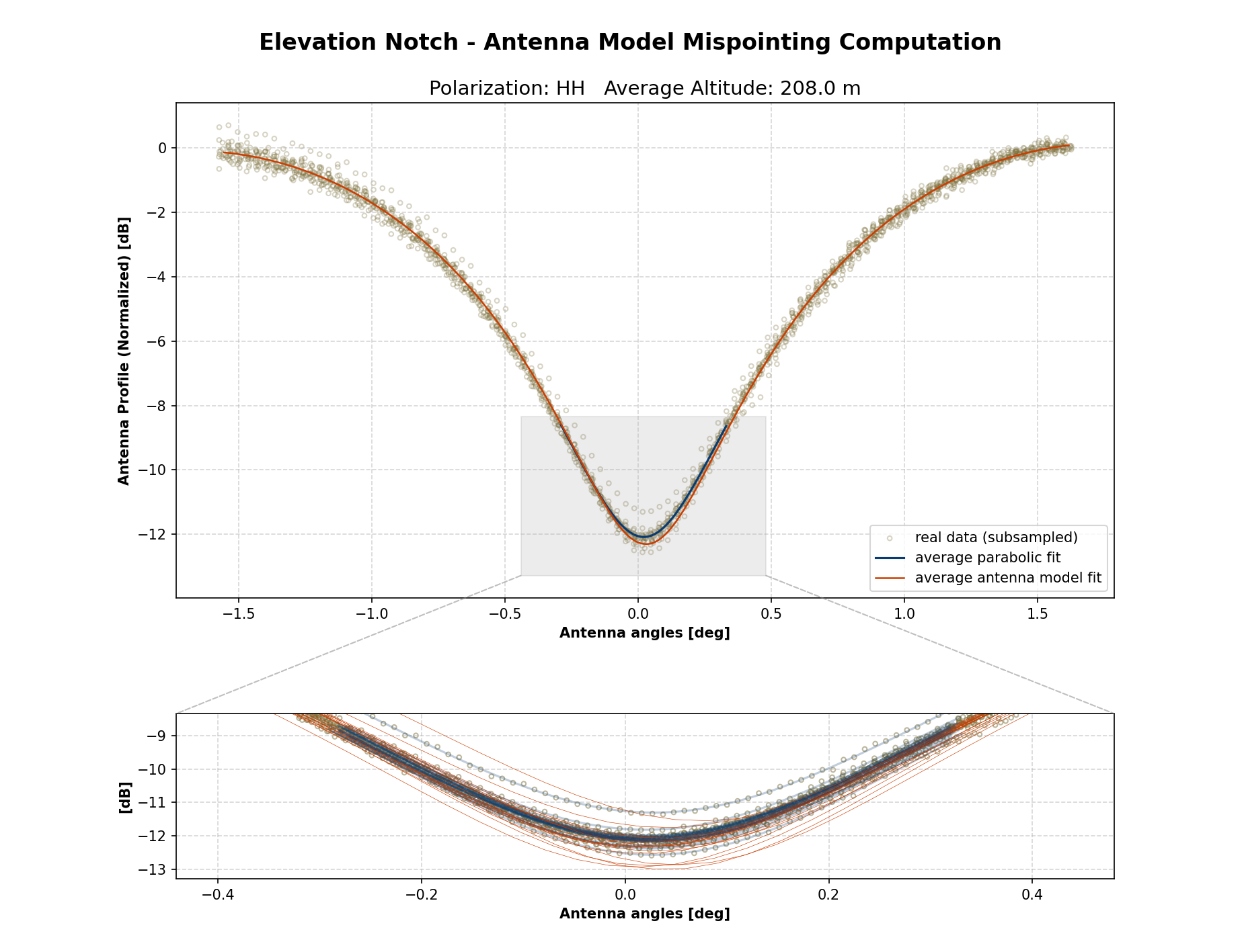
In addition to this estimation procedure based on the Antenna Pattern, another estimation method is carried out using a Parabolic Fit of the data profile minimum. This is always performed and does not require additional inputs other than the product itself.
Analysis Output
Elevation Notch analysis output consists in a NetCDF file containing estimated profiles for each channel analyzed.
Graphical output can also be generated using the graphical_output.plot_elevation_notch_analysis function to obtain
the plots.
Graphical output
Graphical output functionalities are available only if the package has been installed with the [graphs] optional
dependencies.
Refer to the installation documentation for further information on how to install it.